[ PAST_PRESENT_FUTURE ]
The World
As It Is.
The first website to present a comprehensive geopolitical map of the world. The borders reflected in this website are a de facto representation of the political and military situation on the ground throughout the world. This includes occupations deemed as illegal by international law. The objective is to understand the actual situation on the ground, making analysis and comprehension of events easier.
Ground
Truth.
When borders shift overnight, official maps fail. Atlynx tracks contested administration in real-time — providing an objective view of who actually controls the soil, regardless of diplomatic recognition.
Global
Arteries.
90% of global trade moves by sea. We visualize chokepoint congestion, fleet density, and economic vulnerability — from the Strait of Malacca to the Suez Canal.
The Geopolitical
Lens.
Alliances, military bases, contested island chains, naval deployments — Atlynx layers the invisible architecture of global power onto the map. Toggle NATO infrastructure, Five Eyes networks, Indo-Pacific flashpoints, and more.
Through
Time.
From the Peloponnesian War to today's contested borders. The 431 B.C. map reconstructs the ancient world on the eve of history's most documented conflict — explore how power has shifted across millennia.
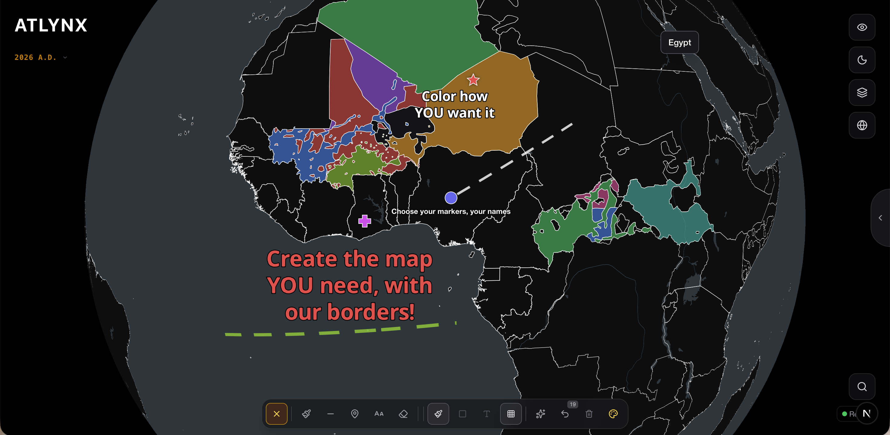
Photo
Mode.
Annotate the map with custom colors, markers, lines, and text. Build publication-ready legends. Export high-resolution PNGs with a single click — designed for analysts, journalists, and researchers.

Alessandro Coletta.
Founder of Atlynx · Student at Sciences Po
I built Atlynx to understand how the world really looks today — and how it looked in the past, because the present is only legible through the lens of what came before.
[email protected]